It
is possible to ascend Moberly Peak a couple of ways; the most popular
route follows the mining road on the west side and gains the south
ridge. ***This access is gated and has a No Trespassing-Private Property
sign; it's a working silica mine and access is prohibited, even on
sundays.*** Another way exists using the north-east ridge leading to
the summit block's eastern aspect.
North-east
ridge: Drive on Golden Donald Upper
Road, turn right on Barber Road then left on Oster Road. Park
at the trailhead for Hospital Creek FSR, 033883; a restriction on
motorized vehicles is in effect from may to end of august. Hike or bike
the service
road beyond two sets of switchbacks and pass by an overgrown side road;
turn on the branch road that soon follows, about 5 kilometers, 051912.
This short (1.4 km) deactivated
road
leads to a landing in a cutblock, 050918. Ascend the cutblock and
bushwhack to
Moberly's north-east ridge, following the ridge to the summit block.
Traverse on the east face and ascend climber's left of the rocky gully
on
grassy terrain (see pictures), this shallow gully leads to the notch
between the airy
south ridge and the summit. |
|
 |
|
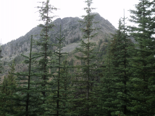
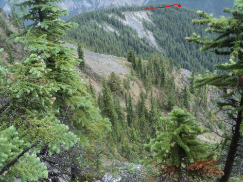
Moberly Peak's east aspect from the short deactivated service road, the summit is right of the notch. |
|  |
|
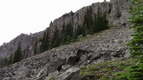
| Ascending typical terrain to the north-east ridge. |
| Scramble:
RT 9.5; 4.75 up. The weather was
unstable pretty much everywhere in the mountains. We woke early to
attempt a trip south of here, it was pouring rain. Not
feeling enthusiastic about the long drive and hike in poor weather, I
suggested we re-visit Moberly; this would allow the addition of a link with directions
to the website. This peak was among the first peaks we ascended in
Golden, way before the digital era; we live right by it! When we went
the first time, we biked the gated mine road and ascended the south
ridge to the airy connecting ridge. This time, we planned to access
from the east face. We left from the house wearing rain gear. At
the cutblock, we left the heavy gear behind and relied on a
lighter version: a garbage bag. The shrubs were wet, gaiters came in
handy as we headed through the clearing and bushwhacked to the
north-east ridge. The mosquitoes were the worst so far this season and
they ensured we kept moving. We followed a game trail on the ridge and
eventually traversed onto the east face/gully of Moberly. Before
engaging in the gully, the rain picked up again, really hard. We
retreated under a big pine tree and waited for a while until the rain
fizzled out. The upper mountain was engulfed in low cloud but we had a
good idea where to go to gain the notch between the airy ridge and true
summit. We traversed into the gully and made our way towards a grassy
shallow gully climber's left of tougher rockier terrain. I was happy to
see the notch ahead, this route grants a relatively easy access. From
there, we scrambled over the highpoint to the wooden cross. The sun was
now filtering through several cloud layers, it was neat. We went back
to the notch for lunch and the drizzle started again. Fabrice traversed
the airy ridge to take pictures of the memorial plaque we had seen
on our first trip. He recognized the section of the ridge and looked
for the plaque that isn't there any more... I waited at the notch as the
rain intensified; although the scramble on the ridge is moderate, the
wet lichen covered rock combined with exposure isn't compelling. When
he returned, we finished lunch and started heading down. We got home
early and surprised the doggies with a fun afternoon at home! |
|
 |
| Getting closer to the summit block. |
|
 |
| Traversing to the east gully. |
|
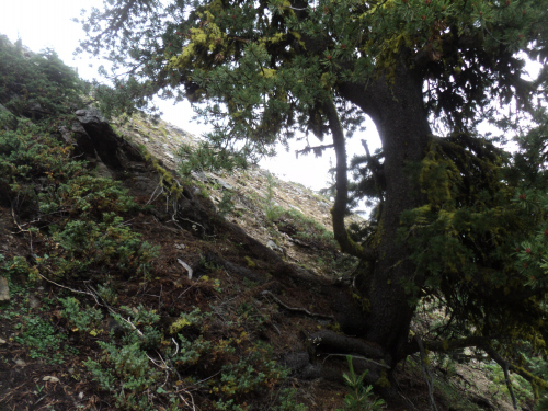 |
| Leaving the tree that sheltered us from a heavy downpour. |
|
 |
|
| Scooting climber's left to avoid the rocky gully. |
|
|
 |
|
| A shallow grassy gully easily leads to the notch. |
|
|
 |
|
| Reaching the notch engulfed in low clouds and drizzle. |
|
|
 |
|
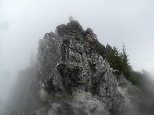
| The summit is in the center. |
|
|
 |
|
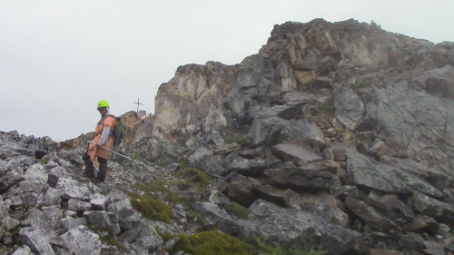
| This airy ridge grants a moderate traverse, a memorial plaque used to exist at the south end. |
|
|
 |
|
| A short gully on the west side leads to the top. |
|
|  |
|
| Walking to the wooden cross with beautiful cloud layers. |
|
|  |
|
| The view south towards our home is obstructed by low clouds. |
|
|
 |
|
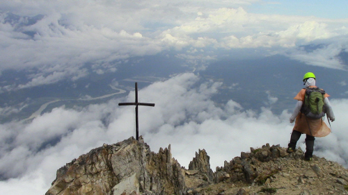
| Fabrice joins me at the cross. |
|
|
 |
|
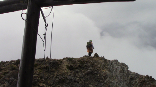
| Walking back over the summit as the drizzle intensifies. |
|
|
 |
|
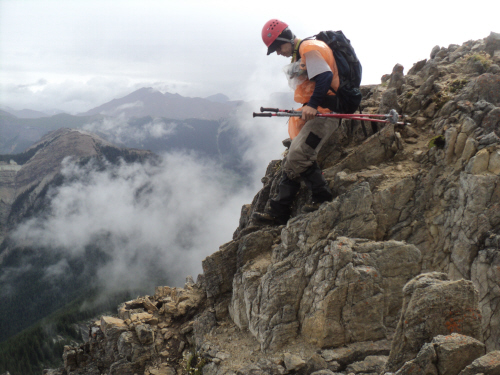
| Down to the short gully and hopefully not the abyss on the left. |
|
|
 |
|
| Fab undertakes the traverse of the airy ridge to take a picture of the memorial plaque which isn't there anymore. |
|
|
 |
|
| Heading back. |
|
|  |
|
| Following the shallow gully and cairns we placed. |
|
|  |
|
| Traversing to the north-east ridge. |
|
|  |
|
| Dogs are waiting at home! |
|
|  |
|
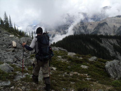
| Looking back at the route we took. |
|
|  |
|
| The rain stops as we near the north-east ridge. |
|
|  |
|
| On the ridge we followed a game trail. |
|
|  |
|
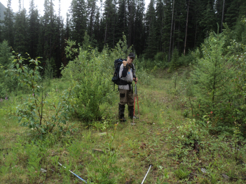
| A reasonable bushwhack delivers us to the landing. |
| Back to home page |
|
|