From Pritchard, drive up Martin Prairie Road. At a T-intersection,
054145, veer right on what appears to be a service road; it is a
continuation of Martin Prairie Road (to the left is Silver Birch Lane).
During winter, you may only be able to drive as far as the private
property on the north side of the road, 055143. Continue about 300 meters
to an intersection and go right on a secondary road, 058141. Follow
that road; go straight at 055132 and past a fence line. At 044117, a
crude cutline heads towards a landing, 046116 and the mountain's
north-west ridge. From there, pick your way up the mountainside aiming
for a bench at 046110. Head east, climbing a highpoint and circumvent
the drainage until it's easy to reach the summit plateau. Walk the
summit plateau to the south end, the broad summit is at 056096.
***Other route options are possible.***
|
|

|
|
Parked near a private entrance (left), I'm not going any further. |
|
 |
|
|
This guy should have made the same decision!
|
Snowshoe
trip: RT 8.5; 5.5 up. Mount Martin is diminutive and located in a
region that would never be considered worthwhile visiting by any
scrambler. However, I found myself admiring it on my drives from
Kamloops; it does stand out compared to its surroundings. I decided to
pack down an uptrack part way to the summit during a weekday hoping
Milan and the kids could accompany me to the top the following weekend.
The start of my trek was quite easy but when I veered off the service
road and began to climb, it was clear that this objective would be an
ordeal. The terrain is steep at the start and postholing was knee-deep.
I had a
moment of respite when I gained the bench atop the north-west ridge but
it was short-lived. I
continued climbing until the long detour, which avoids a major
drainage,
revealed itself. That circumvention cost me a lot of time and
effort. The snow was unconsolidated; additionally, there was lots of
deadfall and juvenile trees which
increased weakness in the snowpack. Although that section of terrain
was flat, breaking trail was brutal to say
the least. At that point, I figured I had to reach the summit because
it was unlikely the kids would make it and I didn't want to come back.
I was
thrilled to set foot on the summit plateau. The walk to the south
end seemed pleasant compared to the tough push I'd just done. The
filtered sun felt warm and there
wasn't much wind. When I reached the broad summit, I sat on a log to
enjoy the partially obscured view and accomplishment. Returning was way
quicker as expected but I felt sore. This small mountain really kicked
my butt!
|
|

|
|
Approaching Mount Martin, I'll continue on the road until I reach the north-west ridge (far right).
|
|
|
|
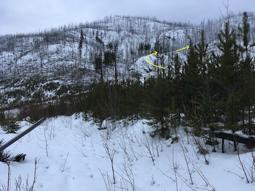
Aiming for the rib in the middle.
|
|

|
|
Steep at the start.
|
|

|
|
|
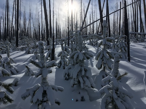
Postholing will be the theme of the day...
|
|
|

|
|
|
The rib led to a shallow gully where avalanche debris provided firmer footing.
|
|
|

|
|
|
Cresting on a bench with a good view of the summit plateau (right).
|
|
|

|
|
|
Looking back.
|
|
|

|
|
|
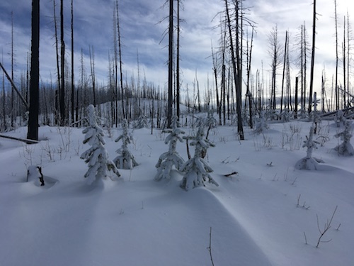
Typical terrain as I circumvent a major drainage on my way to the summit plateau.
|
|
|

|
|
|
Looking back at my lengthy circumvention.
|
|
|
|
|
|
Postholing makes travel really slow.
|
|
|
|
|
|
Finally nearing the summit plateau.
|
|
|

|
|
|
Looking north, Sun Peaks is in the far distance. |
|
|

|
|
|
Snowshoeing to the south end of the summit plateau.
|
|
|

|
|
|
Western view.
|
|
|
 |
|
|
Enjoying the top.
|
|
|
 |
|
|
South-western view.
|
|
|
 |
|
|
Filtered sun and rimmed trees.
|
|
|
 |
|
|
Leaving the summit.
|
|
|
 |
|
|
View along the South Thompson River towards Kamloops.
|
|
|
 |
|
|
Following my trench.
|
|
|
 |
|
|
About to retrace my steps down the gully.
|
|
|
 |
|
|
Quick descent on the access rib.
|
|
|
 |
|
|
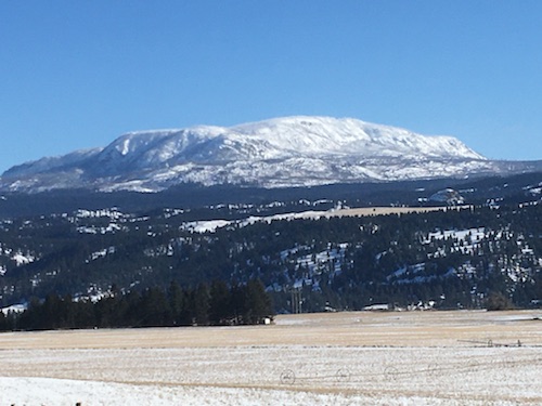
Mount Martin's western aspect.
|
| Back to home page
|
|
|